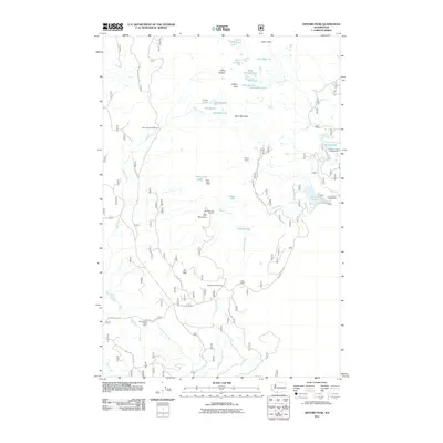
2011 Map of Gifford Peak
USGS Topo · Published 2011About this map
Indian Heaven dominates this high-country landscape, where a dense network of glacial lakes and volcanic peaks define the terrain in the early 21st century. The map provides clear evidence of the area's significance for recreation and traditional land use, notably through the presence of the Indian Race Track and the Red Mountain Lookout. This region is characterized by a high concentration of small water bodies like Rock Lake, Naha Lake, and the Forlorn Lakes, many of which are accessible only by forest roads. A developed network of timber and access routes, such as Nat For Dev RD 65, connects various primitive sites including the Falls Creek Horse Camp and Racetrack Forest Camp. The geography suggests a managed wilderness geared toward backcountry exploration, with the peaks of Gifford Peak and Berry Mountain standing as prominent landmarks above the drainages of Panther Creek and Falls Creek.
Find a feature on this map
45 named features on this map. Tap any name to fly to it.
Don’t see what you’re looking for? This feature index may not catch every label — zoom into the map to look around manually.
Map Details
Editions of this 2011 Gifford Peak Map
This is the sole edition of this map. No revisions or reprints were ever made.
Other maps of this area

1926 · Steamboat Mtn
USGS Topo · 1:125,000

1926 · Hood River
USGS Topo · 1:125,000

1929 · Hood River
USGS Topo · 1:125,000

1931 · Steamboat Mtn
USGS Topo · 1:125,000

1950 · Yakima
USGS Topo · 1:250,000

1953 · The Dalles
USGS Topo · 1:250,000

1956 · The Dalles
USGS Topo · 1:250,000

1957 · The Dalles
USGS Topo · 1:250,000

1957 · Wind River
USGS Topo · 1:62,500

1957 · Willard
USGS Topo · 1:62,500