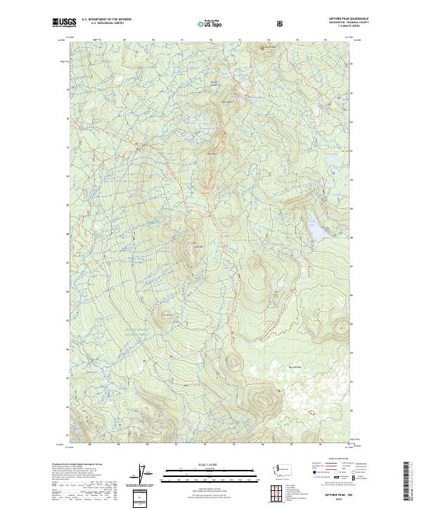
2023 Map of Gifford Peak
USGS Topo · Published 2023About this map
Gifford Peak and the high volcanic plateau of the Indian Heaven Wilderness dominate this portion of the Gifford Pinchot National Forest. This landscape is defined by its remarkable density of small alpine water bodies, including the Basin Lakes, Forlorn Lakes, and Race Track Lakes. These features are connected by an extensive network of recreational routes, most notably the Pacific Crest National Scenic Trl, which traverses the center of the quadrangle.
Find a feature on this map
42 named features on this map. Tap any name to fly to it.
Don’t see what you’re looking for? This feature index may not catch every label — zoom into the map to look around manually.
Map Details
Editions of this 2023 Gifford Peak Map
This is the sole edition of this map. No revisions or reprints were ever made.
Other maps of this area

1926 · Steamboat Mtn
USGS Topo · 1:125,000

1926 · Hood River
USGS Topo · 1:125,000

1929 · Hood River
USGS Topo · 1:125,000

1931 · Steamboat Mtn
USGS Topo · 1:125,000

1950 · Yakima
USGS Topo · 1:250,000

1953 · The Dalles
USGS Topo · 1:250,000

1956 · The Dalles
USGS Topo · 1:250,000

1957 · The Dalles
USGS Topo · 1:250,000

1957 · Wind River
USGS Topo · 1:62,500

1957 · Willard
USGS Topo · 1:62,500