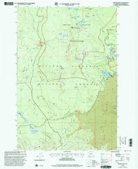
1998 Map of Gifford Peak
USGS Topo · Published 2003About this map
Indian Heaven Wilderness dominates this high-altitude landscape in the late 1990s, defined by its clusters of subalpine lakes and volcanic features. This area within the Gifford Pinchot National Forest shows a concentrated network of backcountry infrastructure, including the Pacific Crest National Scenic Trail as it winds past Gifford Peak and Berry Mountain. The presence of the Indian Race Track near Upper McClellan Meadows points to the long-standing cultural significance of these meadows and ridges.
Find a feature on this map
44 named features on this map. Tap any name to fly to it.
Don’t see what you’re looking for? This feature index may not catch every label — zoom into the map to look around manually.
Map Details
Editions of this 1998 Gifford Peak Map
This is the sole edition of this map. No revisions or reprints were ever made.
Other maps of this area

1926 · Steamboat Mtn
USGS Topo · 1:125,000

1926 · Hood River
USGS Topo · 1:125,000

1929 · Hood River
USGS Topo · 1:125,000

1931 · Steamboat Mtn
USGS Topo · 1:125,000

1950 · Yakima
USGS Topo · 1:250,000

1953 · The Dalles
USGS Topo · 1:250,000

1956 · The Dalles
USGS Topo · 1:250,000

1957 · The Dalles
USGS Topo · 1:250,000

1957 · Wind River
USGS Topo · 1:62,500

1957 · Willard
USGS Topo · 1:62,500