Loading...
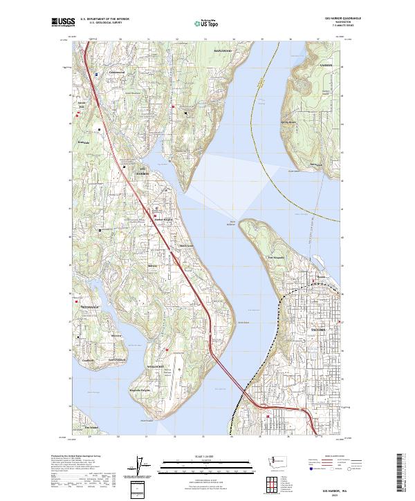
Loading map...2023 Map of Gig Harbor
USGS Topo · Published 2023About this map
The Gig Harbor waterfront and the northern reach of The Narrows define this maritime landscape on the Great Peninsula. This modern survey details the dense residential growth and complex shoreline of the Pierce Co and King Co border, where the Point Defiance - Tahlequah Ferry links the mainland to Vashon Island. Inland, the map documents significant community landmarks including the Tacoma Community College Gig Harbor Campus and the Tacoma Narrows Airport near Wollochet.
Find a feature on this map
57 named features on this map. Tap any name to fly to it.
Don’t see what you’re looking for? This feature index may not catch every label — zoom into the map to look around manually.
Map Details
Date Portrayed2023
Date Published2023
PublisherU.S. Geological Survey
Map TypeTopographic
Scale1:24000
Physical Dimensions24 x 29 inches
Editions of this 2023 Gig Harbor Map
This is the sole edition of this map. No revisions or reprints were ever made.
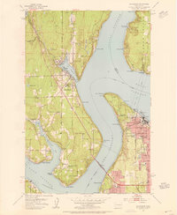
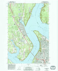
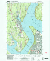
Historical Maps of Tahlequah Through Time
6 maps found


Featured Locations
Source Details
SourceU.S. Geological Survey
CopyrightPublic Domain