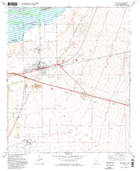
1973 Map of Gila Bend
USGS Topo · Published 1983About this map
Gila Bend emerges as a vital crossroads in the Sonoran Desert in the early 1970s, where the Southern Pacific railroad and Old U.S. Highway 80 converge. The town's grid is flanked by San Lucy Village and the Gila Bend Indian Reservation to the north, while the southern landscape is dominated by aviation and defense infrastructure. The presence of the Gila Bend Air Force Auxiliary Field and the sprawling Luke Air Force Range underscores the area's strategic military importance.
Find a feature on this map
36 named features on this map. Tap any name to fly to it.
Don’t see what you’re looking for? This feature index may not catch every label — zoom into the map to look around manually.
Map Details
Editions of this 1973 Gila Bend Map
2 editions found
Other maps of this area

1950 · Theba
USGS Topo · 1:62,500

1951 · Gila Bend
USGS Topo · 1:62,500

1951 · Theba
USGS Topo · 1:62,500

1951 · Cotton Center
USGS Topo · 1:62,500

1951 · Woolsey Peak
USGS Topo · 1:62,500

1953 · Ajo
USGS Topo · 1:250,000

1954 · Phoenix
USGS Topo · 1:250,000

1957 · Ajo
USGS Topo · 1:250,000

1957 · Phoenix
USGS Topo · 1:250,000

1958 · Ajo
USGS Topo · 1:250,000
Featured Places
- Gila Bend, AZ
- San Lucy District, AZ
- San Lucy Village, San Lucy District
- Maricopa County, AZ
- United States