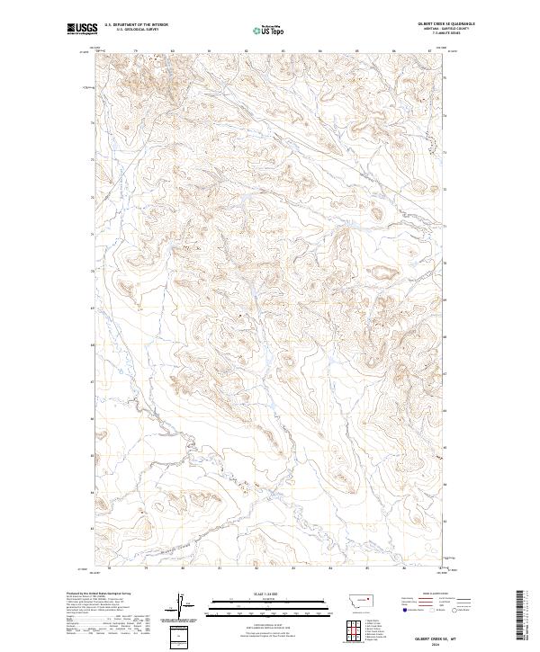
2024 Map of Gilbert Creek SE
USGS Topo · Published 2024About this map
Gilbert Creek and its surrounding drainage systems define this sparsely settled portion of Garfield County. The landscape is marked by the branching headwaters of Flat Creek, Woody Creek, and Pass Creek, which carve out a network of seasonal watercourses and coulees across the high plains. Human presence is indicated primarily by the grid of the Public Land Survey System and a few remote thoroughfares such as Haxby Rd and New Flat Cr Rd. These roads often follow the natural contours of the terrain, providing access to the deep interior of the Montana backcountry. The southern portion of the map is dominated by the broad basin of Redbank Coulee, a significant geographical feature in this dry, rolling environment. This survey provides a clear view of the complex hydrography and basic road infrastructure in a region where the natural topography remains the primary influence on movement and land use.
Find a feature on this map
15 named features on this map. Tap any name to fly to it.
Don’t see what you’re looking for? This feature index may not catch every label — zoom into the map to look around manually.
Map Details
Editions of this 2024 Gilbert Creek SE Map
This is the sole edition of this map. No revisions or reprints were ever made.
Other maps of this area

1954 · Jordan
USGS Topo · 1:250,000

1956 · Jordan
USGS Topo · 1:250,000

1958 · Jordan
USGS Topo · 1:250,000

1964 · Jordan
USGS Topo · 1:250,000

1964 · Bateman Coulee
USGS Topo · 1:24,000

1964 · Bateman Coulee NE
USGS Topo · 1:24,000

1967 · Hagen Gap
USGS Topo · 1:24,000
1972 · Kester School
USGS Topo · 1:24,000
1972 · Gilbert Creek SE
USGS Topo · 1:24,000

1972 · Flat Creek School
USGS Topo · 1:24,000