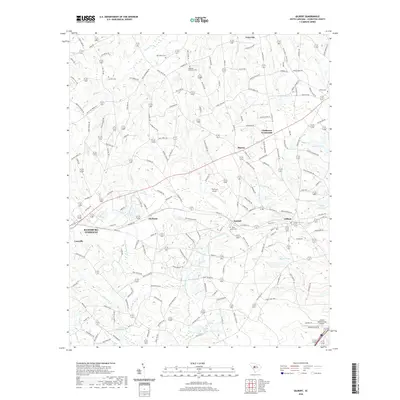
2020 Map of Gilbert
USGS Topo · Published 2020About this map
Gilbert and the surrounding Lexington County countryside are defined by a network of creeks and small impoundments, including Lightwood Knot Cr and Juniper Creek. This survey reveals a landscape of dispersed settlements like Summit and Fredonia, connected by a dense grid of rural roads named for local families, such as Walter Shealy Rd and Devils Backbone Rd. The area's social history is preserved in several community burial grounds, from the Old Salem Cem in the north to the Shiloh Cem near the eastern boundary.
Find a feature on this map
175 named features on this map. Tap any name to fly to it.
Don’t see what you’re looking for? This feature index may not catch every label — zoom into the map to look around manually.
Map Details
Editions of this 2020 Gilbert Map
This is the sole edition of this map. No revisions or reprints were ever made.
Other maps of this area

1904 · Columbia
USGS Topo · 1:125,000

1941 · Spartanburg
USGS Topo · 1:250,000

1944 · Gilbert
USGS Topo · 1:62,500

1953 · Spartanburg
USGS Topo · 1:250,000

1954 · Augusta
USGS Topo · 1:250,000

1957 · Augusta
USGS Topo · 1:250,000

1958 · Augusta
USGS Topo · 1:250,000

1960 · Spartanburg
USGS Topo · 1:250,000

1961 · Augusta
USGS Topo · 1:250,000

1962 · Augusta
USGS Topo · 1:250,000