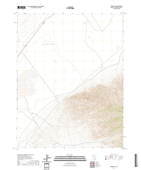
2021 Map of Gilbert SE
USGS Topo · Published 2021About this map
Big Smoky Valley dominates the northern reaches of this Esmeralda County landscape, where the wide desert basin meets the rising slopes of the southern San Antonio Mountains. The map illustrates a high-desert environment defined by extreme relief, transitioning from the flat valley floor to the prominent heights of Lone Mtn in the southeast corner. The terrain is marked by intricate drainage patterns and alluvial fans that spread from the mountain base into the basin, reflecting the characteristic geography of the Great Basin region. Transportation in this arid stretch is anchored by the combined route of U.S. Routes 6 and 95, which cuts through the northwestern corner of the valley. This transit corridor serves as the primary link across the desert flats, connecting distant mining and ranching hubs while following the natural contours of the valley floor.
Find a feature on this map
7 named features on this map. Tap any name to fly to it.
Don’t see what you’re looking for? This feature index may not catch every label — zoom into the map to look around manually.
Map Details
Editions of this 2021 Gilbert SE Map
This is the sole edition of this map. No revisions or reprints were ever made.
Other maps of this area

1898 · Silver Peak
USGS Topo · 1:125,000

1900 · Silver Peak
USGS Topo · 1:125,000

1907 · Tonopah
USGS Topo · 1:250,000

1908 · Lida
USGS Topo · 1:250,000

1908 · Tonopah
USGS Topo · 1:250,000

1913 · Lida
USGS Topo · 1:250,000

1945 · Goldfield
USGS Topo · 1:125,000

1954 · Goldfield
USGS Topo · 1:250,000

1955 · Goldfield
USGS Topo · 1:250,000

1956 · Tonopah
USGS Topo · 1:250,000