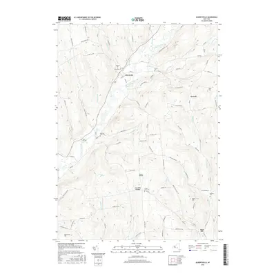
2016 Map of Gilbertsville
USGS Topo · Published 2016About this map
Butternut Creek meanders through this landscape in southern Otsego County, anchoring the village of Gilbertsville. The village layout is defined by its historic core, featuring the Old Churchyard Cem and Brookside Cem near the intersection of Bloom St and Sylvan St. The surrounding countryside is marked by a network of drainage ways including Thorp Brook, Halbert Brook, and Cahoon Cr, which feed the valley floor. To the south, smaller agricultural settlements like Unadilla Center and Rogers Hollow sit among a landscape of prominent high points such as Sisson Hill and Hutchinson Hill. The terrain includes specialized ecological features like the Black Ash Bog, illustrating the varied natural drainage patterns of the region. Local genealogy is well-documented through numerous burial sites, including the Blanchard Cem and Butternut Valley Cem, scattered along the rural road network.
Find a feature on this map
87 named features on this map. Tap any name to fly to it.
Don’t see what you’re looking for? This feature index may not catch every label — zoom into the map to look around manually.
Map Details
Editions of this 2016 Gilbertsville Map
This is the sole edition of this map. No revisions or reprints were ever made.
Other maps of this area

1910 · Hartwick
USGS Topo · 1:62,500

1910 · New Berlin
USGS Topo · 1:62,500

1912 · New Berlin
USGS Topo · 1:62,500

1912 · Hartwick
USGS Topo · 1:62,500

1915 · Oneonta
USGS Topo · 1:62,500

1915 · Unadilla
USGS Topo · 1:62,500

1918 · Unadilla
USGS Topo · 1:62,500

1918 · Oneonta
USGS Topo · 1:62,500

1943 · Sidney
USGS Topo · 1:24,000

1943 · New Berlin South
USGS Topo · 1:24,000