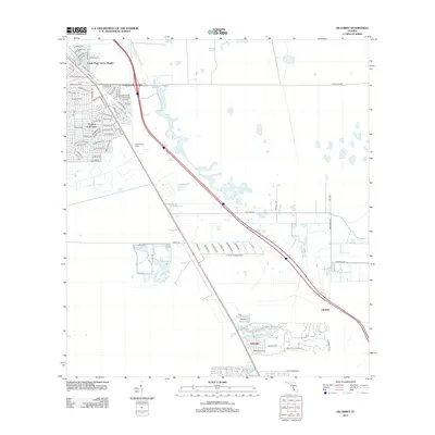
2012 Map of Gilchrist
USGS Topo · Published 2012About this map
South Punta Gorda Heights and Tropical Gulf Acres anchor the developed northwest corner of this Southwest Florida landscape, showcasing an intricate network of residential streets with citrus-themed names like Grapefruit Ln, Lime Dr, and Mango Dr. This residential layout contrasts sharply with the expansive wetlands and water management features to the east, where the S Prong Alligator Cr flows toward the coast. The transport corridor is dominated by the diagonal sweep of Interstate 75 and US Route 41, which pass near the Punta Gorda Tower. To the south, the settlements of Lakeville and Gilchrist sit along the Lee County line, while large-scale drainage patterns and undeveloped platted lots reflect the region's late 20th-century suburban design and environmental management strategies.
Find a feature on this map
81 named features on this map. Tap any name to fly to it.
Don’t see what you’re looking for? This feature index may not catch every label — zoom into the map to look around manually.
Map Details
Editions of this 2012 Gilchrist Map
This is the sole edition of this map. No revisions or reprints were ever made.
Other maps of this area

1956 · Cleveland
USGS Topo · 1:24,000

1956 · Punta Gorda SE
USGS Topo · 1:24,000

1956 · Bermont
USGS Topo · 1:24,000

1956 · West Palm Beach
USGS Topo · 1:250,000

1956 · Tampa
USGS Topo · 1:250,000

1956 · Charlotte Harbor
USGS Topo · 1:250,000

1957 · West Palm Beach
USGS Topo · 1:250,000

1957 · Tuckers Corner
USGS Topo · 1:24,000

1957 · Punta Gorda
USGS Topo · 1:24,000

1957 · Gilchrist
USGS Topo · 1:24,000