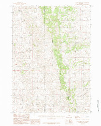
1984 Map of Gillam Draw East
USGS Topo · Published 1984About this map
Pine Ridge dominates the central vertical axis of this 1984 Wyoming survey, marking a distinct elevation change that separates the western drainage systems from the eastern plains. The terrain is defined by a dense network of intermittent watercourses, suggesting a high-desert environment where seasonal flow has deeply etched the landscape. Features like Big Bull Creek, Little Bull Creek, and Antelope Creek converge in the southern portion of the sheet, while the northern reaches are carved by Holmes Draw and Cottonwood Creek.
Find a feature on this map
10 named features on this map. Tap any name to fly to it.
Don’t see what you’re looking for? This feature index may not catch every label — zoom into the map to look around manually.
Map Details
Editions of this 1984 Gillam Draw East Map
This is the sole edition of this map. No revisions or reprints were ever made.
Other maps of this area

1955 · Newcastle
USGS Topo · 1:250,000

1955 · Arminto
USGS Topo · 1:250,000

1958 · Arminto
USGS Topo · 1:250,000

1958 · Newcastle
USGS Topo · 1:250,000

1959 · Fifty-Five Ranch
USGS Topo · 1:62,500

1959 · Edgerton
USGS Topo · 1:62,500

1959 · Ormsby Draw
USGS Topo · 1:62,500

1960 · Ross
USGS Topo · 1:62,500

1962 · Arminto
USGS Topo · 1:250,000

1979 · Bill
USGS Topo · 1:100,000