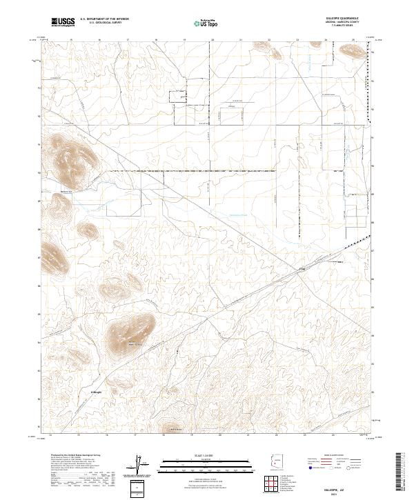
2021 Map of Gillespie
USGS Topo · Published 2021About this map
Yellow Medicine Hills and Black Butte rise above the arid Maricopa County terrain, defining the local topography between broad drainage systems. The landscape is marked by the seasonal pathways of Centennial Wash and Winters Wash, which cross an area transitioning from rugged outcrops to organized ranch and transit corridors. Traces of the region's transportation history are evident in the W Southern Pacific Trl and the presence of Mullens Cut, which carve through the land near the small settlements of Gillespie and Crag. To the north, the orderly grid of Steinway contrasts with the winding Agua Caliente Rd, illustrating the intersection of modern rural development and the established historical routes of the Arizona desert.
Find a feature on this map
20 named features on this map. Tap any name to fly to it.
Don’t see what you’re looking for? This feature index may not catch every label — zoom into the map to look around manually.
Map Details
Editions of this 2021 Gillespie Map
This is the sole edition of this map. No revisions or reprints were ever made.
Other maps of this area

1942 · Vicksburg
USGS Topo · 1:250,000

1951 · Dendora Valley
USGS Topo · 1:62,500

1951 · Woolsey Peak
USGS Topo · 1:62,500

1954 · Phoenix
USGS Topo · 1:250,000

1957 · Phoenix
USGS Topo · 1:250,000

1958 · Phoenix
USGS Topo · 1:250,000

1960 · Phoenix
USGS Topo · 1:250,000

1962 · Cortez Peak
USGS Topo · 1:62,500

1962 · Arlington
USGS Topo · 1:62,500

1969 · Phoenix
USGS Topo · 1:250,000