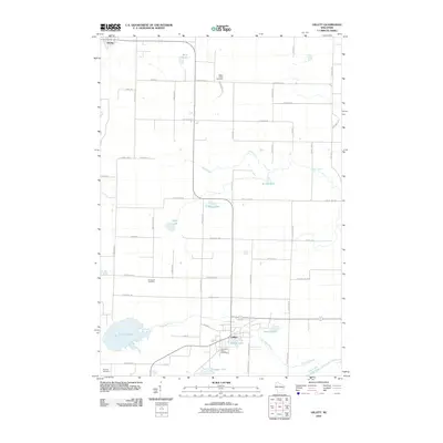
2010 Map of Gillett
USGS Topo · Published 2010About this map
The Oconto River system and its associated tributaries define the hydrography of this northern Wisconsin landscape. Centered around the city of Gillett, the terrain is marked by a concentration of small lakes and family-named landmarks. The presence of Maple Valley Cemetery, Immanuel Cemetery, and Wanderers Rest Cemetery provides specific points of interest for genealogists tracing regional lineages. To the north, the village of Suring sits near Benz Lake, while the lower portion of the sheet is dominated by the waters of Christie Lake and Savage Lake. The network of county highways and local roads, such as Klaus Lake Rd and Mueller Hill Rd, reflects the agricultural and residential development typical of Oconto County during the early 21st century.
Find a feature on this map
56 named features on this map. Tap any name to fly to it.
Don’t see what you’re looking for? This feature index may not catch every label — zoom into the map to look around manually.
Map Details
Editions of this 2010 Gillett Map
This is the sole edition of this map. No revisions or reprints were ever made.
Other maps of this area

1941 · Coleman
USGS Topo · 1:48,000

1942 · Coleman
USGS Topo · 1:48,000

1942 · Breed
USGS Topo · 1:48,000

1950 · Coleman
USGS Topo · 1:48,000

1952 · Mountain
USGS Topo · 1:48,000

1954 · Iron Mountain
USGS Topo · 1:250,000

1955 · Green Bay
USGS Topo · 1:250,000

1956 · Gillett
USGS Topo · 1:62,500

1956 · Oconto Falls
USGS Topo · 1:62,500

1959 · Iron Mountain
USGS Topo · 1:250,000