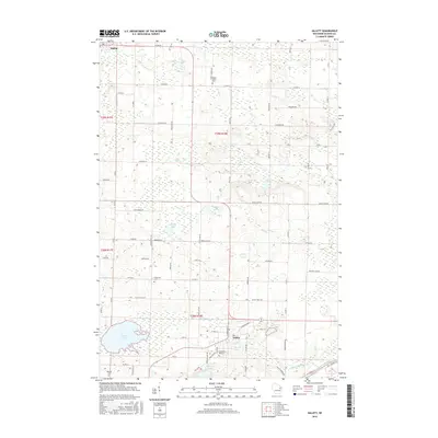
2016 Map of Gillett
USGS Topo · Published 2016About this map
Gillett and Suring serve as the primary hubs in this Oconto County landscape, where the Oconto River winds through the southeastern corner. The area is characterized by an extensive network of small lakes, including Christie Lake, Finnegan Lake, and Klaus Lake, interspersed with rural family-named roads like Mueller Hill Rd and Hoyt Hill Rd. This 2016 data reflects a well-established agricultural and residential pattern, where local heritage is anchored by several long-standing burial grounds such as Wanderer's Rest Cem, Maple Valley Cem, and Immanuel Cem. The drainage of Christie Brook and Daly Cr further defines the low-lying terrain between the small settlements, showing how the local road system adapts to the natural hydrography and wetland pockets typical of this region of Wisconsin.
Find a feature on this map
74 named features on this map. Tap any name to fly to it.
Don’t see what you’re looking for? This feature index may not catch every label — zoom into the map to look around manually.
Map Details
Editions of this 2016 Gillett Map
This is the sole edition of this map. No revisions or reprints were ever made.
Other maps of this area

1941 · Coleman
USGS Topo · 1:48,000

1942 · Coleman
USGS Topo · 1:48,000

1942 · Breed
USGS Topo · 1:48,000

1950 · Coleman
USGS Topo · 1:48,000

1952 · Mountain
USGS Topo · 1:48,000

1954 · Iron Mountain
USGS Topo · 1:250,000

1955 · Green Bay
USGS Topo · 1:250,000

1956 · Gillett
USGS Topo · 1:62,500

1956 · Oconto Falls
USGS Topo · 1:62,500

1959 · Iron Mountain
USGS Topo · 1:250,000