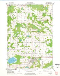
1974 Map of Gillett
USGS Topo · Published 1977About this map
Gillett serves as the primary hub in this mid-1970s landscape, positioned near the junction of the Chicago and North Western railroad and the Oconto River. The map reveals a transition from the structured residential blocks and Sewage Disposal infrastructure of the town to the sprawling agricultural tracts of Maple Valley and Underhill. Small-scale industry is evident in the numerous Gravel Pits scattered across the township, while local community life is anchored by a dense network of country churches like Trinity Ch and Immanuel Ch.
Find a feature on this map
46 named features on this map. Tap any name to fly to it.
Don’t see what you’re looking for? This feature index may not catch every label — zoom into the map to look around manually.
Map Details
Editions of this 1974 Gillett Map
This is the sole edition of this map. No revisions or reprints were ever made.
Other maps of this area

1941 · Coleman
USGS Topo · 1:48,000

1942 · Coleman
USGS Topo · 1:48,000

1942 · Breed
USGS Topo · 1:48,000

1950 · Coleman
USGS Topo · 1:48,000

1952 · Mountain
USGS Topo · 1:48,000

1954 · Iron Mountain
USGS Topo · 1:250,000

1955 · Green Bay
USGS Topo · 1:250,000

1956 · Gillett
USGS Topo · 1:62,500

1956 · Oconto Falls
USGS Topo · 1:62,500

1959 · Iron Mountain
USGS Topo · 1:250,000