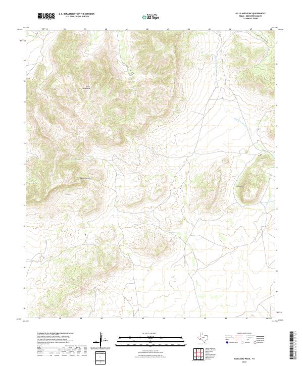
2022 Map of Gilliland Peak
USGS Topo · Published 2022About this map
The Glass Mountains dominate the northern landscape of this Brewster County region, showcasing the distinctive limestone peaks and steep escarpments characteristic of the Trans-Pecos. This topographic study captures the area's high-desert drainage patterns, where Moose Draw and Road Canyon cut through the elevated terrain before giving way to the lower basin. To the south, isolated peaks like Cathedral Mtn and Iron Mtn stand as prominent landmarks, reflecting the complex volcanic and tectonic history of the Marathon Uplift area. The intermittent waters of Peña Colorado Cr meander through the eastern sector, illustrating the vital role of seasonal watercourses in an environment defined by its arid climate and sparse settlement. This modern U.S. Geological Survey representation provides a precise view of the ranching lands and geological formations that have dictated movement and land use in this part of West Texas for generations.
Find a feature on this map
6 named features on this map. Tap any name to fly to it.
Don’t see what you’re looking for? This feature index may not catch every label — zoom into the map to look around manually.
Map Details
Editions of this 2022 Gilliland Peak Map
This is the sole edition of this map. No revisions or reprints were ever made.
Other maps of this area

1920 · Monument Spring
USGS Topo · 1:62,500

1920 · Marathon
USGS Topo · 1:62,500

1921 · Monument Spring
USGS Topo · 1:62,500

1921 · Marathon
USGS Topo · 1:62,500

1923 · Hess Canyon
USGS Topo · 1:62,500

1923 · Altuda
USGS Topo · 1:62,500

1954 · Fort Stockton
USGS Topo · 1:250,000

1958 · Fort Stockton
USGS Topo · 1:250,000

1973 · Fort Stockton
USGS Topo · 1:250,000
1983 · Dugout Mountain
USGS Topo · 1:24,000