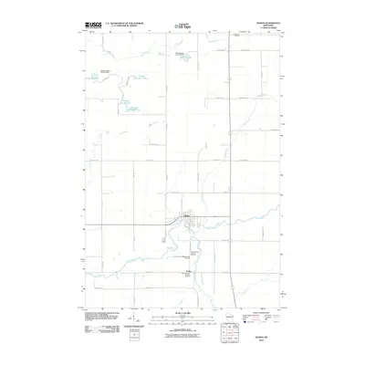
2010 Map of Gilman
USGS Topo · Published 2010About this map
The Yellow River cuts a winding path through this central Wisconsin landscape, anchoring the village of Gilman near its banks. This 2010 survey illustrates a region defined by managed waterways and agricultural grid lines, with the G12.575 Dam creating several distinct reservoirs including Witt Flowage, Sotak Flowage, and a series of numerically designated pools like Flowage Number Three. These water management features suggest the importance of local drainage and recreation in this part of Taylor County.
Find a feature on this map
46 named features on this map. Tap any name to fly to it.
Don’t see what you’re looking for? This feature index may not catch every label — zoom into the map to look around manually.
Map Details
Editions of this 2010 Gilman Map
This is the sole edition of this map. No revisions or reprints were ever made.
Other maps of this area

1945 · Black River
USGS Topo · 1:48,000

1947 · Sheldon
USGS Topo · 1:48,000

1949 · Sheldon
USGS Topo · 1:48,000

1949 · Jump River Fire Tower
USGS Topo · 1:48,000

1951 · Lublin
USGS Topo · 1:48,000

1951 · Gilman
USGS Topo · 1:62,500

1953 · Rice Lake
USGS Topo · 1:250,000

1959 · Rice Lake
USGS Topo · 1:250,000
1969 · Lublin
USGS Topo · 1:24,000
1969 · Lublin NW
USGS Topo · 1:24,000