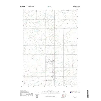
2018 Map of Gilman
USGS Topo · Published 2018About this map
Gilman serves as the primary hub of this Northwoods landscape, situated where the Yellow River flows through Taylor County. The village layout is clearly defined by a grid including Main ST, Pine ST, and E Mcsloy ST. To the south, the smaller settlement of Polley sits near a concentrated cluster of community burial grounds, including Meadowbrook Cem, Meadowbrook Lutheran Cem, and Meadowbrook Catholic Cem.
Find a feature on this map
60 named features on this map. Tap any name to fly to it.
Don’t see what you’re looking for? This feature index may not catch every label — zoom into the map to look around manually.
Map Details
Editions of this 2018 Gilman Map
This is the sole edition of this map. No revisions or reprints were ever made.
Other maps of this area

1945 · Black River
USGS Topo · 1:48,000

1947 · Sheldon
USGS Topo · 1:48,000

1949 · Sheldon
USGS Topo · 1:48,000

1949 · Jump River Fire Tower
USGS Topo · 1:48,000

1951 · Lublin
USGS Topo · 1:48,000

1951 · Gilman
USGS Topo · 1:62,500

1953 · Rice Lake
USGS Topo · 1:250,000

1959 · Rice Lake
USGS Topo · 1:250,000
1969 · Lublin
USGS Topo · 1:24,000
1969 · Lublin NW
USGS Topo · 1:24,000