Loading...
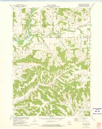
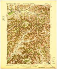
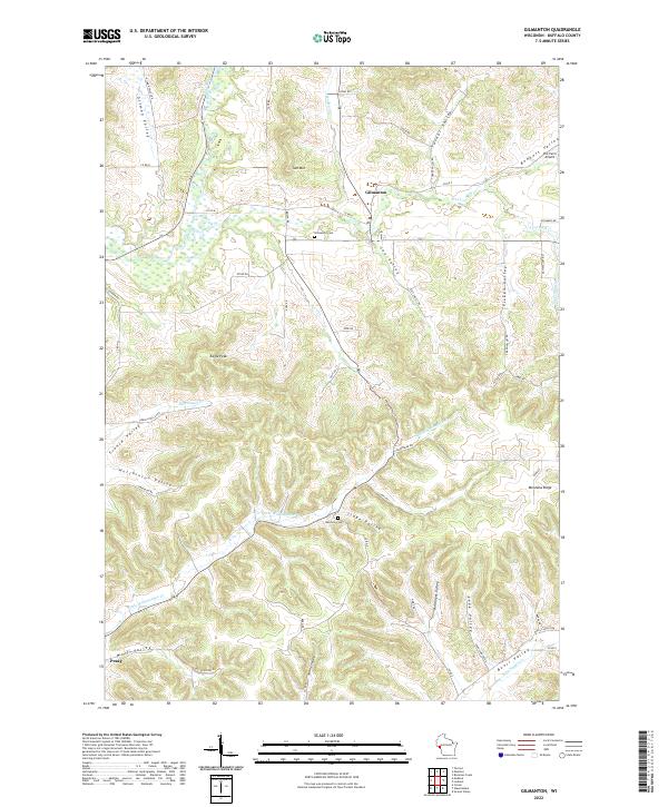
Loading map...1973 Map of Gilmanton
USGS Topo · Published 1975About this map
Gilmanton stands as the primary settlement in this Wisconsin interior, situated at the confluence of Hadley Creek and Elk Creek. The landscape transitions from the broad floodplains of the Buffalo River in the northwest to a deeply dissected plateau characterized by intricate ridge-and-valley systems. High points such as Tom Mountain and Eagle Peak provide orientation across the townships of Gilmanton and Montana.
Find a feature on this map
33 named features on this map. Tap any name to fly to it.
Don’t see what you’re looking for? This feature index may not catch every label — zoom into the map to look around manually.
Map Details
Date Portrayed1973
Date Published1975
PublisherU.S. Geological Survey
Map TypeTopographic
Scale1:24,000
Physical Dimensions21.61 x 27.29 inches
Editions of this 1973 Gilmanton Map
This is the sole edition of this map. No revisions or reprints were ever made.
Historical Maps of Montana Through Time
3 maps found
Featured Locations
Source Details
SourceU.S. Geological Survey
CopyrightPublic Domain