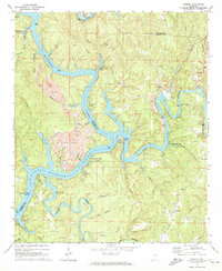
1971 Map of Gilmore
USGS Topo · Published 1973About this map
The Mulberry Fork Black Warrior River dominates this landscape, winding through the borderlands of Walker and Jefferson Counties. During this early 1970s period, the river’s shoreline is dotted with recreation and utility camps, such as Howton Camp, Vines Camp, and Bluff Creek Camp, highlighting the waterway's role as a social and recreational hub. Industrial activity is equally prominent, with extensive strip mines and a large Tailings Pond near Maxine showing the region's reliance on extraction. Transport infrastructure is anchored by the Louisville and Nashville railroad and vital river crossings like the Franklin Ferry Bridge. Local family and community roots are evident in landmarks such as the Prescott Cem, Alliance Sch, and small settlements like Gilmore, providing a detailed look at the rural-industrial character of the Alabama interior before further modernization altered these riverbank communities.
Find a feature on this map
63 named features on this map. Tap any name to fly to it.
Don’t see what you’re looking for? This feature index may not catch every label — zoom into the map to look around manually.
Map Details
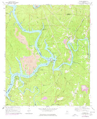
Editions of this 1971 Gilmore Map
2 editions found
Other maps of this area

1893 · Jasper
USGS Topo · 1:125,000

1899 · Brookwood
USGS Topo · 1:125,000

1927 · Adger
USGS Topo · 1:48,000

1929 · Searles
USGS Topo · 1:48,000

1932 · Yolande
USGS Topo · 1:62,500

1934 · Searles
USGS Topo · 1:62,500

1935 · Port Birmingham
USGS Topo · 1:48,000

1935 · Yolande
USGS Topo · 1:62,500

1938 · Port Birmingham
USGS Topo · 1:62,500

1949 · Parrish
USGS Topo · 1:24,000