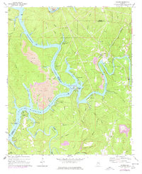
1971 Map of Gilmore
USGS Topo · Published 1977About this map
Bankhead Lake dominates this Alabama landscape, formed by the confluence of the Mulberry Fork Black Warrior River and the Locust Fork. The river-bound economy of the early 1970s is evident in the numerous water-access settlements like Taylor Ferry Camp, Howton Camp, and Vines Camp that line the winding shores. While the water defines the geography, industry leaves a heavy mark on the terrain through significant strip mining operations and a massive tailings pond near Maxine.
Find a feature on this map
61 named features on this map. Tap any name to fly to it.
Don’t see what you’re looking for? This feature index may not catch every label — zoom into the map to look around manually.
Map Details
Editions of this 1971 Gilmore Map
2 editions found
Other maps of this area

1893 · Jasper
USGS Topo · 1:125,000

1899 · Brookwood
USGS Topo · 1:125,000

1927 · Adger
USGS Topo · 1:48,000

1929 · Searles
USGS Topo · 1:48,000

1932 · Yolande
USGS Topo · 1:62,500

1934 · Searles
USGS Topo · 1:62,500

1935 · Port Birmingham
USGS Topo · 1:48,000

1935 · Yolande
USGS Topo · 1:62,500

1938 · Port Birmingham
USGS Topo · 1:62,500

1949 · Parrish
USGS Topo · 1:24,000