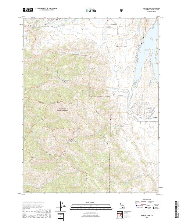
2021 Map of Gilmore Peak
USGS Topo · Published 2021About this map
Stonyford serves as a primary hub of settlement in this northern California landscape, located near the Stonyford Cem and the waters of Stony Creek. The terrain is characterized by a series of prominent ridges and canyons within the Mendocino National Forest, including the namesake Gilmore Peak and the high ground of Lovelady Ridge. These elevations provide the headwaters for numerous drainage systems such as Little Stony Creek and Sullivan Creek.
Find a feature on this map
76 named features on this map. Tap any name to fly to it.
Don’t see what you’re looking for? This feature index may not catch every label — zoom into the map to look around manually.
Map Details
Editions of this 2021 Gilmore Peak Map
This is the sole edition of this map. No revisions or reprints were ever made.
Other maps of this area

1920 · Venado
USGS Topo · 1:62,500

1924 · Bartlett Springs
USGS Topo · 1:62,500

1942 · Bartlett Springs
USGS Topo · 1:62,500

1943 · Lodoga
USGS Topo · 1:62,500

1944 · Bartlett Springs
USGS Topo · 1:62,500

1944 · Wilbur Springs
USGS Topo · 1:62,500

1951 · Stonyford
USGS Topo · 1:62,500

1957 · Ukiah
USGS Topo · 1:250,000

1960 · Ukiah
USGS Topo · 1:250,000
1960 · Clearlake Oaks
USGS Topo · 1:62,500