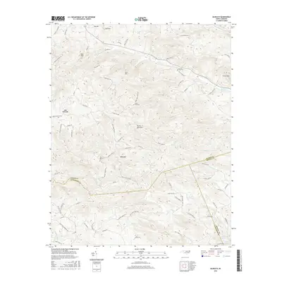
2016 Map of Gilreath
USGS Topo · Published 2016About this map
Old Gilreath and Gilreath anchor this portion of the Brushy Mountains, where the modern landscape meets historical family and church sites along the borders of Wilkes, Alexander, and Iredell Counties. The area is defined by sharp topographic shifts, rising from the waters of Rocky Cr and Hunting Cr to summits like Pilot Mtn and Fitches Knob. Genealogists will find significant value in the distribution of local burial grounds, including Old Bethany Cem, Cherry Grove Cem, and Hunting Creek Cem. The road network, including Old Salisbury Rd and Linneys Mill Rd, reflects the long-standing transit routes through the gaps of these southern Appalachian foothills. In the southern reaches, the Vashti Fire Department Rd and Fox Mountain Lake provide modern landmarks in this deeply etched terrain of ridges and creek beds.
Find a feature on this map
81 named features on this map. Tap any name to fly to it.
Don’t see what you’re looking for? This feature index may not catch every label — zoom into the map to look around manually.
Map Details
Editions of this 2016 Gilreath Map
This is the sole edition of this map. No revisions or reprints were ever made.
Other maps of this area

1889 · Wilkesboro
USGS Topo · 1:125,000

1891 · Wilkesboro
USGS Topo · 1:125,000

1891 · Yadkinville
USGS Topo · 1:125,000

1893 · Statesville
USGS Topo · 1:125,000

1893 · Yadkinville
USGS Topo · 1:125,000

1895 · Hickory
USGS Topo · 1:125,000

1953 · Charlotte
USGS Topo · 1:250,000

1953 · Winston-Salem
USGS Topo · 1:250,000

1954 · Charlotte
USGS Topo · 1:250,000

1955 · Winston-Salem
USGS Topo · 1:250,000