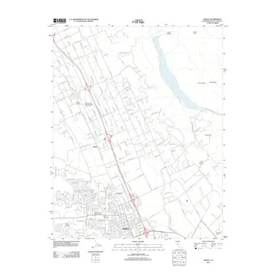
2012 Map of Gilroy
USGS Topo · Published 2012About this map
The city of Gilroy serves as the focal point for this survey of the southern Santa Clara Valley, where the transition from agricultural traditions to suburban development is clearly visible. The landscape is defined by its viticultural heritage, with the San Martin Vineyards, Conrotto Winery, and Paul Masson Winery dotting the valley floor. To the east, the terrain rises into Timber Ridge and Sheep Ridge, where the large expanse of Coyote Lake is fed by Coyote Creek. Residential expansion radiates from the city center near the Independent Order of Oddfellows Cemetery and Saint Marys Cemetery, while outlying communities like Rucker and Lonoke maintain their distinct positions along the Monterey Highway corridor. The intricate drainage network of Llagas Creek, Miller Slough, and Alamos Creek illustrates the complex hydrology of this alluvial plain, supporting both the local estates and the South County Airport of Santa Clara County.
Find a feature on this map
181 named features on this map. Tap any name to fly to it.
Don’t see what you’re looking for? This feature index may not catch every label — zoom into the map to look around manually.
Map Details
Editions of this 2012 Gilroy Map
This is the sole edition of this map. No revisions or reprints were ever made.
Other maps of this area

1915 · San Juan Bautista
USGS Topo · 1:48,000

1917 · Morgan Hill
USGS Topo · 1:62,500

1917 · San Juan Bautista
USGS Topo · 1:62,500

1919 · Hollister
USGS Topo · 1:48,000

1921 · Gilroy Hot Springs
USGS Topo · 1:62,500

1921 · Hollister
USGS Topo · 1:62,500

1923 · Hollister
USGS Topo · 1:62,500

1939 · Morgan Hill
USGS Topo · 1:62,500

1939 · Gilroy Hot Springs
USGS Topo · 1:62,500

1939 · San Juan Bautista
USGS Topo · 1:62,500