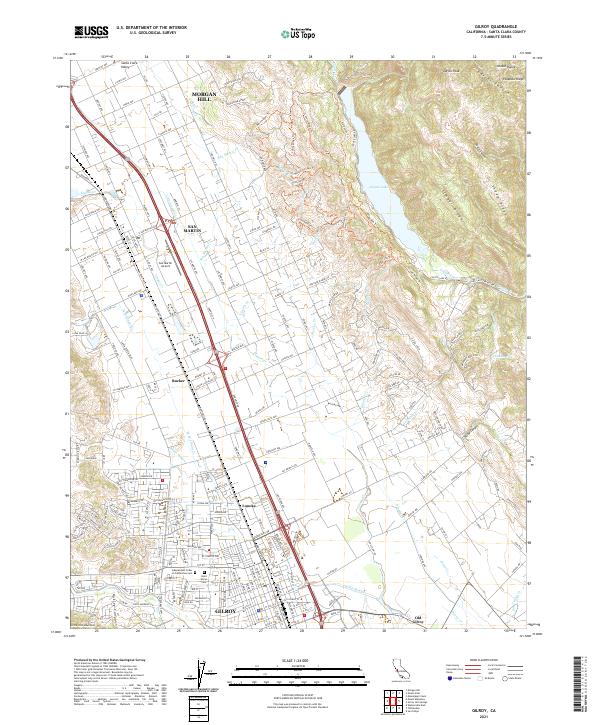
2021 Map of Gilroy
USGS Topo · Published 2021About this map
The Santa Clara Valley serves as a primary corridor for settlement and transit, anchored by the city of Gilroy and the nearby communities of Morgan Hill and San Martin. This modern survey illustrates the intensive grid of the valley floor, where the Union Pacific railroad parallels Monterey St, marking a path through smaller historic locales such as Rucker and Lonoke. To the east, the terrain rises sharply into the Diablo Range, featuring landmarks like Larios Peak and the recreational waters of Coyote Lake. This landscape is defined by the drainage of several local waterways, including Llagas Cr and its tributaries, which flow across the flatlands toward the Santa Cruz Mountains in the west. Genealogists and researchers will find the location of Old Gilroy and Saint Marys Cem of particular interest for tracing early family footprints in the region.
Find a feature on this map
120 named features on this map. Tap any name to fly to it.
Don’t see what you’re looking for? This feature index may not catch every label — zoom into the map to look around manually.
Map Details
Editions of this 2021 Gilroy Map
This is the sole edition of this map. No revisions or reprints were ever made.
Other maps of this area

1915 · San Juan Bautista
USGS Topo · 1:48,000

1917 · Morgan Hill
USGS Topo · 1:62,500

1917 · San Juan Bautista
USGS Topo · 1:62,500

1919 · Hollister
USGS Topo · 1:48,000

1921 · Gilroy Hot Springs
USGS Topo · 1:62,500

1921 · Hollister
USGS Topo · 1:62,500

1923 · Hollister
USGS Topo · 1:62,500

1939 · Morgan Hill
USGS Topo · 1:62,500

1939 · Gilroy Hot Springs
USGS Topo · 1:62,500

1939 · San Juan Bautista
USGS Topo · 1:62,500