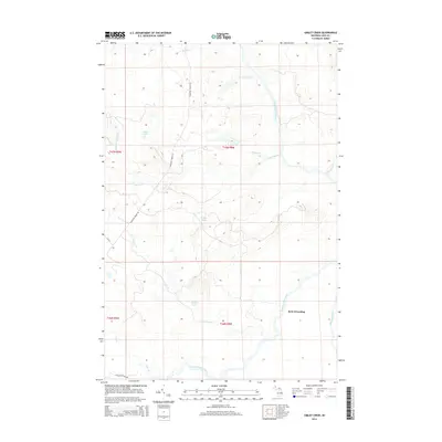
2014 Map of Gimlet Creek
USGS Topo · Published 2014About this map
Betty B Landing serves as a lone named point of settlement along the winding course of the Tahquamenon River in this remote section of Luce County. The landscape is defined by its complex network of swampy lowlands and isolated basins, including Island Lake, Laurel Lake, and Gimlet Lake. These water bodies are connected by a myriad of small tributaries such as Gimlet Cr, Freeman Cr, and Murphy Creek.
Find a feature on this map
21 named features on this map. Tap any name to fly to it.
Don’t see what you’re looking for? This feature index may not catch every label — zoom into the map to look around manually.
Map Details
Editions of this 2014 Gimlet Creek Map
This is the sole edition of this map. No revisions or reprints were ever made.
Other maps of this area

1951 · Big Beaver Creek
USGS Topo · 1:24,000

1951 · Hulbert
USGS Topo · 1:24,000

1951 · Timberlost
USGS Topo · 1:24,000

1951 · Eckerman
USGS Topo · 1:62,500

1951 · Shelldrake
USGS Topo · 1:62,500

1954 · Sault Sainte Marie
USGS Topo · 1:250,000

1956 · Sault Sainte Marie
USGS Topo · 1:250,000

1957 · Sault Sainte Marie
USGS Topo · 1:250,000

1958 · Sault Sainte Marie
USGS Topo · 1:250,000

1968 · Betsy Lake SW
USGS Topo · 1:24,000