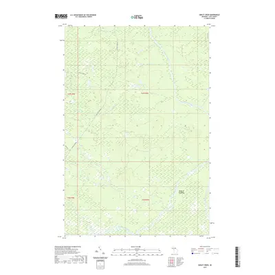
2019 Map of Gimlet Creek
USGS Topo · Published 2019About this map
The Tahquamenon River winds through this expanse of Michigan’s Upper Peninsula, joined by several tributaries including Freeman Cr and Atwood Cr. This landscape is defined by its complex hydrology, where Gimlet Lake and Laurel Lake sit amidst vast wetlands and feeder streams like Gimlet Cr and Savage Cr. The river system served as a primary artery for the region's early industries, a history subtly reflected in names like Charcoal Grade Rd. Settlement is sparse, with Betty B Landing serving as a notable point of access along the river. In the southeastern corner, the Hendrie River flows through the lowlands, while several local routes such as Murphy Creek Rd and Skyline Rd provide passage through the dense forest and marsh terrain.
Find a feature on this map
20 named features on this map. Tap any name to fly to it.
Don’t see what you’re looking for? This feature index may not catch every label — zoom into the map to look around manually.
Map Details
Editions of this 2019 Gimlet Creek Map
This is the sole edition of this map. No revisions or reprints were ever made.
Other maps of this area

1951 · Big Beaver Creek
USGS Topo · 1:24,000

1951 · Hulbert
USGS Topo · 1:24,000

1951 · Timberlost
USGS Topo · 1:24,000

1951 · Eckerman
USGS Topo · 1:62,500

1951 · Shelldrake
USGS Topo · 1:62,500

1954 · Sault Sainte Marie
USGS Topo · 1:250,000

1956 · Sault Sainte Marie
USGS Topo · 1:250,000

1957 · Sault Sainte Marie
USGS Topo · 1:250,000

1958 · Sault Sainte Marie
USGS Topo · 1:250,000

1968 · Betsy Lake SW
USGS Topo · 1:24,000