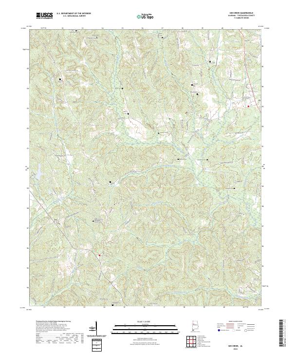
2024 Map of Gin Creek
USGS Topo · Published 2024About this map
Mount Zion Free Will Baptist Church Cem and Phillips Chapel Cem stand as prominent landmarks in this rural landscape of northern Tuscaloosa County. The terrain is defined by a dense network of drainages, including the headwaters of Binion Creek, Wolf Creek, and Gin Creek, which have carved the area into a complex series of ridges and hollows. This topography is reflected in the winding path of Old Fayette Rd and numerous family-named routes such as Murk Montgomery Rd and Billy Bigham Rd.
Find a feature on this map
89 named features on this map. Tap any name to fly to it.
Don’t see what you’re looking for? This feature index may not catch every label — zoom into the map to look around manually.
Map Details
Editions of this 2024 Gin Creek Map
This is the sole edition of this map. No revisions or reprints were ever made.
Other maps of this area

1926 · Samantha
USGS Topo · 1:48,000

1928 · Samantha
USGS Topo · 1:62,500

1953 · Birmingham
USGS Topo · 1:250,000

1956 · Birmingham
USGS Topo · 1:250,000

1957 · Birmingham
USGS Topo · 1:250,000

1967 · Brownville
USGS Topo · 1:24,000

1967 · Newtonville
USGS Topo · 1:24,000

1967 · Elrod
USGS Topo · 1:24,000
1967 · New Lexington
USGS Topo · 1:24,000
1967 · Berry SE
USGS Topo · 1:24,000