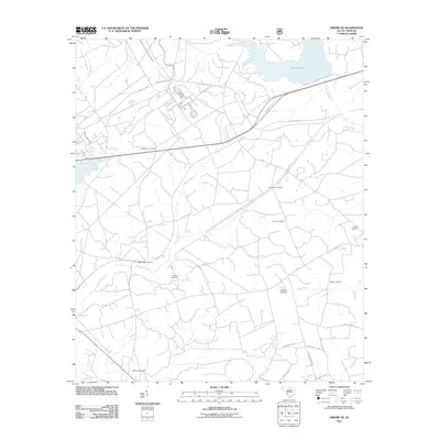
2011 Map of Girard NE
USGS Topo · Published 2011About this map
Singleton Cemetery and Dunbar Cemetery stand as primary landmarks in this 2011 survey of Barnwell County, illustrating the deep-rooted family history of the South Carolina lowcountry. The landscape is defined by the managed waters of Par Pond and Pond Five, alongside natural drainages like Steel Creek and Meyers Branch. The infrastructure of the region is punctuated by the Dunbarton Fire Tower and the remnants of the rail era at Meyers Mill Siding, which sits near the crossing of Dunbarton Blvd. This modern topographic study reveals a territory characterized by extensive secondary roads and farm lanes, such as Hanberry Farm Rd, winding through the drainage basins of Furse Mill Creek and Lower Three Runs.
Find a feature on this map
26 named features on this map. Tap any name to fly to it.
Don’t see what you’re looking for? This feature index may not catch every label — zoom into the map to look around manually.
Map Details
Editions of this 2011 Girard NE Map
This is the sole edition of this map. No revisions or reprints were ever made.
Other maps of this area

1919 · Allendale
USGS Topo · 1:62,500

1920 · Ellenton
USGS Topo · 1:48,000

1920 · Talatha
USGS Topo · 1:48,000

1921 · Talatha
USGS Topo · 1:62,500

1921 · Ellenton
USGS Topo · 1:62,500

1923 · Williston
USGS Topo · 1:48,000

1927 · Williston
USGS Topo · 1:62,500

1943 · Allendale
USGS Topo · 1:62,500

1943 · Augusta East
USGS Topo · 1:125,000

1943 · Williston
USGS Topo · 1:62,500