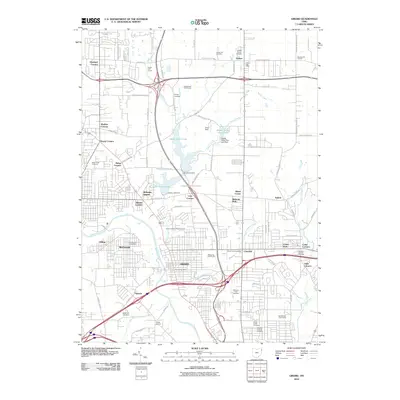
2010 Map of Girard
USGS Topo · Published 2010About this map
The Mahoning River corridor defines the industrial and residential heart of this region, where the city of Girard and the village of McDonald stand as primary hubs. This 2010 survey illustrates the dense network of crossroads and named corners that characterize the local geography, such as Tibbetts Corners, Loys Corners, and Sodom. The landscape is notably marked by significant water management features, including Upper Girard Lake and Lower Girard Lake, which are constrained by the Lake Girard Dam and Liberty Lake Dam.
Find a feature on this map
85 named features on this map. Tap any name to fly to it.
Don’t see what you’re looking for? This feature index may not catch every label — zoom into the map to look around manually.
Map Details
Editions of this 2010 Girard Map
This is the sole edition of this map. No revisions or reprints were ever made.
Other maps of this area

1905 · Bristolville
USGS Topo · 1:62,500

1906 · Youngstown
USGS Topo · 1:62,500

1907 · Kinsman
USGS Topo · 1:62,500

1907 · Bristolville
USGS Topo · 1:62,500

1908 · Youngstown
USGS Topo · 1:62,500

1908 · Warren
USGS Topo · 1:62,500

1950 · Cleveland
USGS Topo · 1:250,000

1951 · Campbell
USGS Topo · 1:24,000

1951 · Youngstown
USGS Topo · 1:24,000

1952 · Canfield
USGS Topo · 1:24,000