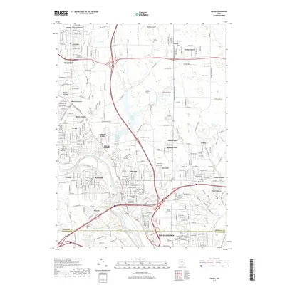
2019 Map of Girard
USGS Topo · Published 2019About this map
The Mahoning River corridor and its industrial legacy define this landscape between Warren and Youngstown. Historically significant burial grounds are concentrated in the southern sector, including Anshe Emeth Cem, Tod Homestead Cem, and Children of Israel Cem, reflecting the diverse cultural fabric of the steel valley. The hydrological network is dominated by the Upper Girard Lake and Lower Girard Lake reservoirs, which were originally developed to support the intensive water needs of the region's manufacturing base.
Find a feature on this map
279 named features on this map. Tap any name to fly to it.
Don’t see what you’re looking for? This feature index may not catch every label — zoom into the map to look around manually.
Map Details
Editions of this 2019 Girard Map
This is the sole edition of this map. No revisions or reprints were ever made.
Other maps of this area

1905 · Bristolville
USGS Topo · 1:62,500

1906 · Youngstown
USGS Topo · 1:62,500

1907 · Kinsman
USGS Topo · 1:62,500

1907 · Bristolville
USGS Topo · 1:62,500

1908 · Youngstown
USGS Topo · 1:62,500

1908 · Warren
USGS Topo · 1:62,500

1950 · Cleveland
USGS Topo · 1:250,000

1951 · Campbell
USGS Topo · 1:24,000

1951 · Youngstown
USGS Topo · 1:24,000

1952 · Canfield
USGS Topo · 1:24,000