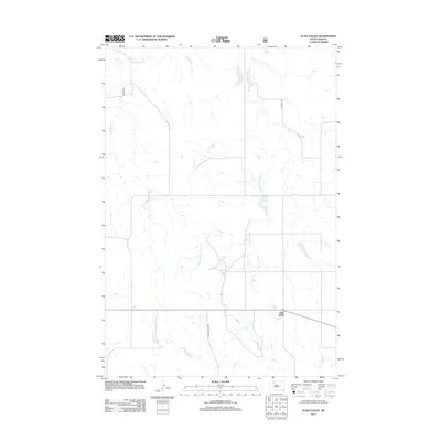
2012 Map of Glad Valley
USGS Topo · Published 2012About this map
Glad Valley anchors this corner of the Dakota plains, serving as a focal point for the surrounding prairie homesteads and ranch lands. The landscape is defined by the intricate drainage systems of the Twin Butte Cr, which branch out into several significant tributaries including the W Fork E Twin Butte Cr and the E Fork E Twin Butte Cr. These seasonal waterways cut through the open terrain, dictating the placement of rural infrastructure. Connectivity in this remote section of Ziebach County relies on a sparse network of arterial routes such as Thunder Butte Rd and Co Road S 33, reflecting a century-old pattern of settlement where life and travel are closely tied to the natural contours of the northern plains.
Find a feature on this map
6 named features on this map. Tap any name to fly to it.
Don’t see what you’re looking for? This feature index may not catch every label — zoom into the map to look around manually.
Map Details
Editions of this 2012 Glad Valley Map
This is the sole edition of this map. No revisions or reprints were ever made.
Other maps of this area

1953 · McIntosh
USGS Topo · 1:250,000

1956 · Cottonwood Creek SW
USGS Topo · 1:24,000

1958 · McIntosh
USGS Topo · 1:250,000

1972 · Black Horse Butte
USGS Topo · 1:24,000

1972 · Twin Butte
USGS Topo · 1:24,000

1980 · McIntosh
USGS Topo · 1:100,000

1982 · Glad Valley
USGS Topo · 1:24,000

1982 · Glad Valley SW
USGS Topo · 1:24,000

1982 · Glad Valley NW
USGS Topo · 1:24,000

1982 · Irish Creek SW
USGS Topo · 1:24,000