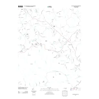
2013 Map of Glade Valley
USGS Topo · Published 2013About this map
Sparta and the surrounding high country of the Blue Ridge define this 2013 survey of the northern North Carolina borderlands. The landscape is marked by a network of creeks and small settlements like Glade Valley and Cherry Lane that have persisted through generations of mountain life. Significant landmarks such as Bullhead Mountain and Mahogany Rock Mountain dominate the central terrain, while the Little Glade Millpond serves as a notable local water feature. The survey illustrates the modern road network, including the path to the Stone Mountain Overlook, which provides access to the dramatic topography of Devils Garden. This map is a record of the region's complex geography, from the headwaters of the E Prong Roaring River to the residential development radiating from the town center, preserving the placement of family-named roads and remote mountain gaps like Deep Gap.
Find a feature on this map
178 named features on this map. Tap any name to fly to it.
Don’t see what you’re looking for? This feature index may not catch every label — zoom into the map to look around manually.
Map Details
Editions of this 2013 Glade Valley Map
This is the sole edition of this map. No revisions or reprints were ever made.
Other maps of this area

1889 · Hillsville
USGS Topo · 1:125,000

1889 · Wytheville
USGS Topo · 1:125,000

1889 · Wilkesboro
USGS Topo · 1:125,000

1891 · Wilkesboro
USGS Topo · 1:125,000

1891 · Yadkinville
USGS Topo · 1:125,000

1892 · Hillsville
USGS Topo · 1:125,000

1892 · Wytheville
USGS Topo · 1:125,000

1893 · Yadkinville
USGS Topo · 1:125,000

1896 · Hillsville
USGS Topo · 1:125,000

1930 · Independence
USGS Topo · 1:48,000