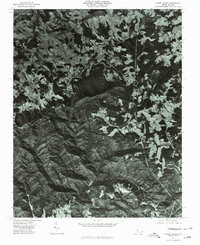
1976 Map of Glade Valley
USGS Topo · Published 1979About this map
Sparta and the surrounding high-elevation plateau of Alleghany County are documented here through 1976 aerial photography. This orthophotoquad provides a clear view of the complex land-use patterns where the agricultural clearings of Glade Valley and Cherry Lane meet the steep, forested slopes of the Blue Ridge. The imagery reveals the sharp transition from the rolling pastoral fields of the upland to the dramatic escarpment defined by Bullhead Mountain and Mahogany Rock Mountain. To the south, the massive granite exposures of Stone Mountain stand out against the deep timber of the mountain slopes. These records are invaluable for tracing mid-century farm boundaries, forest encroachment on old pastures, and the early layout of mountain communities before modern development altered the rural character of the North Carolina highlands.
Find a feature on this map
8 named features on this map. Tap any name to fly to it.
Don’t see what you’re looking for? This feature index may not catch every label — zoom into the map to look around manually.
Map Details
Editions of this 1976 Glade Valley Map
This is the sole edition of this map. No revisions or reprints were ever made.
Other maps of this area

1889 · Hillsville
USGS Topo · 1:125,000

1889 · Wytheville
USGS Topo · 1:125,000

1889 · Wilkesboro
USGS Topo · 1:125,000

1891 · Wilkesboro
USGS Topo · 1:125,000

1891 · Yadkinville
USGS Topo · 1:125,000

1892 · Hillsville
USGS Topo · 1:125,000

1892 · Wytheville
USGS Topo · 1:125,000

1893 · Yadkinville
USGS Topo · 1:125,000

1896 · Hillsville
USGS Topo · 1:125,000

1930 · Independence
USGS Topo · 1:48,000