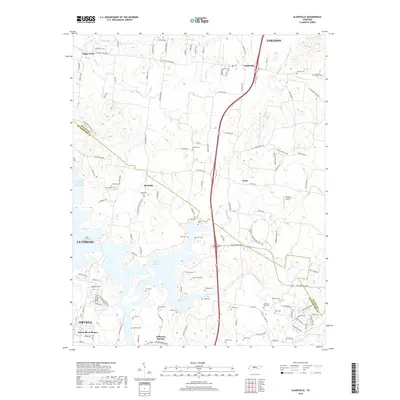
2019 Map of Gladeville
USGS Topo · Published 2019About this map
J Percy Priest Reservoir dominates the southern landscape of this Rutherford County and Wilson County region, where the sprawling waters have transformed the valley around Jefferson Springs. The terrain is marked by distinctive natural and man-made features, from the Vesta Cedar Glade to the modern logistics and transportation hubs near La Vergne. Extensive genealogical data is preserved throughout the rural uplands, with dozens of family burial sites including Spickard-Sullivan Cem, Charleton Ford Cem, and Lannom Cem dotting the countryside between Gladeville and Rockdale. The presence of the TK Farms Airport and major thoroughfares like Stewarts Ferry Pike and Couchville Pike illustrate the area's role as a vital corridor between Smyrna and the surrounding townships.
Find a feature on this map
116 named features on this map. Tap any name to fly to it.
Don’t see what you’re looking for? This feature index may not catch every label — zoom into the map to look around manually.
Map Details
Editions of this 2019 Gladeville Map
This is the sole edition of this map. No revisions or reprints were ever made.
Other maps of this area

1903 · Nashville
USGS Topo · 1:125,000

1916 · Murfreesboro
USGS Topo · 1:62,500

1932 · Hermitage
USGS Topo · 1:62,500

1942 · Lebanon
USGS Topo · 1:100,000

1950 · Walterhill
USGS Topo · 1:24,000

1951 · Lebanon
USGS Topo · 1:24,000

1951 · Martha
USGS Topo · 1:24,000

1952 · Hermitage
USGS Topo · 1:24,000

1952 · La Vergne
USGS Topo · 1:24,000

1956 · Vine
USGS Topo · 1:24,000