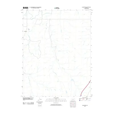
2010 Map of Gladstone
USGS Topo · Published 2010About this map
The Cottonwood River and the South Fork Cottonwood River converge in this section of Chase County, defining a landscape shaped by persistent watercourses and agricultural drainage. This 2010 survey documents the rural settlement of Gladstone, situated near the northwestern corner of the quadrangle. The map is particularly useful for local history and genealogy, noting the location of Miller Cemetery perched on a rise above the river valley. Numerous seasonal and perennial streams, including the vividly named Bloody Creek, Little Bloody Creek, and Spring Creek, dissect the terrain. In the southwestern reaches, the South Fork Norton Creek flows through open country, illustrating the intricate watershed patterns characteristic of the Kansas prairie before the landscape transitions toward the more developed corridors of the region.
Find a feature on this map
8 named features on this map. Tap any name to fly to it.
Don’t see what you’re looking for? This feature index may not catch every label — zoom into the map to look around manually.
Map Details
Editions of this 2010 Gladstone Map
This is the sole edition of this map. No revisions or reprints were ever made.
Other maps of this area

1888 · Emporia
USGS Topo · 1:125,000

1894 · Emporia
USGS Topo · 1:125,000

1898 · Cottonwood Falls
USGS Topo · 1:125,000

1955 · Hutchinson
USGS Topo · 1:250,000

1957 · Strong City
USGS Topo · 1:24,000

1957 · Saffordville
USGS Topo · 1:24,000

1957 · Plymouth
USGS Topo · 1:24,000

1959 · Hutchinson
USGS Topo · 1:250,000

1973 · Matfield Green
USGS Topo · 1:24,000

1973 · Shaw Creek
USGS Topo · 1:24,000