
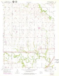
1957 Map of Plymouth
USGS Topo · Published 1958About this map
The meandering path of the Cottonwood River and the Neosho River dominate the landscape of Lyon County in the late 1950s. This survey records the rural settlements of Plymouth and Toledo, positioned just north of the vital Atchison Topeka and Santa Fe railroad corridor. The settlement pattern reflects a deeply rooted agrarian community, evidenced by several country schools like the Cottonwood School and the already noted Liberty Sch (Abandoned). Local genealogy is well-documented through numerous sites including Hillside Cemetery, Grandview Cemetery, and Hayworth Cemetery. The map captures a moment when traditional landmarks like the Saffordville Church and Cottonwood Church served as community anchors alongside industrial features such as the Oil Tanks near the railroad tracks.
Find a feature on this map
25 named features on this map. Tap any name to fly to it.
Don’t see what you’re looking for? This feature index may not catch every label — zoom into the map to look around manually.
Map Details
Editions of this 1957 Plymouth Map
2 editions found
Other maps of this area

1885 · Eskridge
USGS Topo · 1:125,000

1888 · Emporia
USGS Topo · 1:125,000

1889 · Eskridge
USGS Topo · 1:125,000

1894 · Emporia
USGS Topo · 1:125,000

1894 · Eskridge
USGS Topo · 1:125,000

1955 · Hutchinson
USGS Topo · 1:250,000

1957 · Emporia
USGS Topo · 1:24,000

1957 · Saffordville
USGS Topo · 1:24,000

1959 · Hutchinson
USGS Topo · 1:250,000
1972 · Allen SW
USGS Topo · 1:24,000