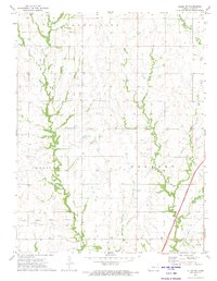
1972 Map of Allen SW
USGS Topo · Published 1974About this map
The Old Indian Treaty Boundary slices diagonally across this Lyon County landscape, serving as a silent reminder of former land divisions in central Kansas. This 1970s survey captures a transition in the rural environment, where traditional agricultural boundaries in Agnes City, Americus, and Fremont meet the modern infrastructure of the Kansas Toll Road Turnpike. Waterways such as Allen Creek, Stillman Creek, and Duck Creek dictate the drainage of the terrain, while several localized cemeteries provide significant genealogical markers for the area. Researchers will find the Old Indian Treaty Boundary Township Cem, Frost Cem, and Rosean Cem clearly identified, anchoring family histories to specific sections of the prairie. The map also records the path of a major Pipeline cutting through the western sections, illustrating the utility corridors that began to define the mid-century rural landscape.
Find a feature on this map
12 named features on this map. Tap any name to fly to it.
Don’t see what you’re looking for? This feature index may not catch every label — zoom into the map to look around manually.
Map Details
Editions of this 1972 Allen SW Map
This is the sole edition of this map. No revisions or reprints were ever made.
Other maps of this area

1885 · Eskridge
USGS Topo · 1:125,000

1888 · Emporia
USGS Topo · 1:125,000

1889 · Eskridge
USGS Topo · 1:125,000

1894 · Emporia
USGS Topo · 1:125,000

1894 · Eskridge
USGS Topo · 1:125,000

1955 · Hutchinson
USGS Topo · 1:250,000

1957 · Lang
USGS Topo · 1:24,000

1957 · Emporia
USGS Topo · 1:24,000

1957 · Plymouth
USGS Topo · 1:24,000

1959 · Hutchinson
USGS Topo · 1:250,000