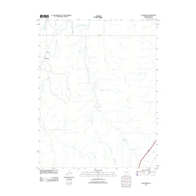
2012 Map of Gladstone
USGS Topo · Published 2012About this map
Gladstone sits at the western edge of this Chase County landscape, situated where the S Fork Cottonwood River joins the main Cottonwood River channel. The terrain is defined by a dense network of drainage systems, including Bloody Cr and its tributary Little Bloody Cr, which carve through the prairie. Genealogists will note the Miller Cem located north of the primary settlement, a key landmark for local family history research. The map reflects a rural infrastructure based on long-established routes such as Road 140 and RS 1918, illustrating the persistent layout of the Flint Hills region in the early 21st century. The hydrological pattern of creeks like Spring Cr and Norton Cr underscores the area's agricultural character and the natural water sources that have dictated land use for generations.
Find a feature on this map
11 named features on this map. Tap any name to fly to it.
Don’t see what you’re looking for? This feature index may not catch every label — zoom into the map to look around manually.
Map Details
Editions of this 2012 Gladstone Map
This is the sole edition of this map. No revisions or reprints were ever made.
Other maps of this area

1888 · Emporia
USGS Topo · 1:125,000

1894 · Emporia
USGS Topo · 1:125,000

1898 · Cottonwood Falls
USGS Topo · 1:125,000

1955 · Hutchinson
USGS Topo · 1:250,000

1957 · Strong City
USGS Topo · 1:24,000

1957 · Saffordville
USGS Topo · 1:24,000

1957 · Plymouth
USGS Topo · 1:24,000

1959 · Hutchinson
USGS Topo · 1:250,000

1973 · Matfield Green
USGS Topo · 1:24,000

1973 · Shaw Creek
USGS Topo · 1:24,000