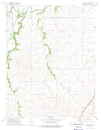
1973 Map of Gladstone
USGS Topo · Published 1975About this map
The small community of Gladstone sits at a strategic transit point in the Flint Hills region, where the Atchison Topeka and Santa Fe railroad meets the winding course of the Cottonwood River. This 1973 survey illustrates the local agricultural landscape, punctuated by landmarks of rural life and infrastructure like the Miller Cem and a Booster Station. The terrain is defined by a series of branching waterways, including Stout Run, South Fork, and the colorfully named Bloody Creek with its tributary, Little Bloody Creek. In the southeastern corner, the modern footprint of the Kansas Turnpike Toll Road cuts through the countryside near an active Quarry, showing the shift toward high-speed automotive transit. The map reflects a mid-century balance between the traditional railroad-and-river economy and the expanding network of interstate highways and underground pipelines.
Find a feature on this map
15 named features on this map. Tap any name to fly to it.
Don’t see what you’re looking for? This feature index may not catch every label — zoom into the map to look around manually.
Map Details
Editions of this 1973 Gladstone Map
This is the sole edition of this map. No revisions or reprints were ever made.
Other maps of this area

1888 · Emporia
USGS Topo · 1:125,000

1894 · Emporia
USGS Topo · 1:125,000

1898 · Cottonwood Falls
USGS Topo · 1:125,000

1955 · Hutchinson
USGS Topo · 1:250,000

1957 · Strong City
USGS Topo · 1:24,000

1957 · Saffordville
USGS Topo · 1:24,000

1957 · Plymouth
USGS Topo · 1:24,000

1959 · Hutchinson
USGS Topo · 1:250,000

1973 · Matfield Green
USGS Topo · 1:24,000

1973 · Shaw Creek
USGS Topo · 1:24,000