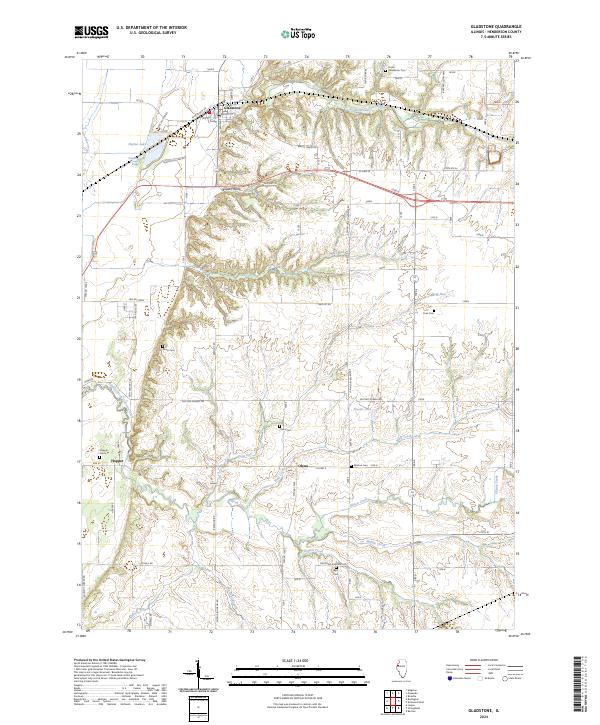
2024 Map of Gladstone
USGS Topo · Published 2024About this map
Gladstone sits at the northern edge of this Henderson County landscape, where the flatlands meet a complex network of creeks and drainage systems. The terrain south of town is defined by Bogus Hollow and the winding course of South Henderson Creek, illustrating the transition from agricultural plateaus to the low-lying areas near Gladstone Lake. Significant infrastructure like the Ellison Creek Diversion Ditch and numerous rural thoroughfares such as Lake Dutton Rd and Beulah Blvd reflect a managed rural landscape designed for water control and connectivity.
Find a feature on this map
45 named features on this map. Tap any name to fly to it.
Don’t see what you’re looking for? This feature index may not catch every label — zoom into the map to look around manually.
Map Details
Editions of this 2024 Gladstone Map
This is the sole edition of this map. No revisions or reprints were ever made.
Other maps of this area

1918 · La Harpe
USGS Topo · 1:62,500

1932 · Lomax
USGS Topo · 1:62,500

1934 · Oquawka
USGS Topo · 1:48,000

1934 · Burlington
USGS Topo · 1:48,000

1937 · Lomax
USGS Topo · 1:62,500

1940 · Oquawka
USGS Topo · 1:62,500

1940 · Burlington
USGS Topo · 1:62,500

1958 · Burlington
USGS Topo · 1:250,000

1961 · Burlington
USGS Topo · 1:250,000

1963 · Burlington
USGS Topo · 1:250,000