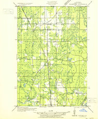
1932 Map of Gladstone NE
USGS Topo · Published 1932About this map
The Chicago and Northwestern railroad forms the spine of this industrial and agricultural landscape within the township of Brampton. Surveyed in the early 1930s, the map reveals a network of small settlements and rural education hubs like Youngs Sch and Days River Sch that once served the families of Delta County. The terrain is defined by the high ground of Maple Ridge and a complex hydrological system where the Tacoosh River and Days River flow toward Little Bay de Noc. Cultural markers, including St Josephs Cem and the St Josephs church, anchor the community of Perkins. This era shows the transition of the Upper Peninsula interior as early logging sites like Johnson Camp and rail sidings at Winde integrated with established rural life along State Highway No 35.
Find a feature on this map
27 named features on this map. Tap any name to fly to it.
Don’t see what you’re looking for? This feature index may not catch every label — zoom into the map to look around manually.
Map Details
Editions of this 1932 Gladstone NE Map
2 editions found
Other maps of this area

1932 · Gladstone NE
USGS Topo · 1:31,680

1932 · Rock SW
USGS Topo · 1:31,680

1932 · Trenary SW
USGS Topo · 1:31,680

1932 · Gladstone SE
USGS Topo · 1:31,680

1932 · Rapid River NW
USGS Topo · 1:31,680

1932 · Rock SE
USGS Topo · 1:31,680

1932 · Rapid River SW
USGS Topo · 1:31,680

1932 · Gladstone SW
USGS Topo · 1:31,680

1932 · Gladstone NW
USGS Topo · 1:31,680

1950 · Gladstone NW
USGS Topo · 1:31,680