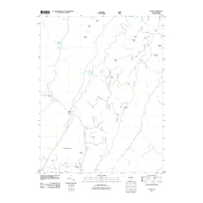
2011 Map of Glady
USGS Topo · Published 2011About this map
Shavers Fork and Glady Fork define the high-elevation drainage patterns of this Randolph County landscape, where the settlements of Glady and Bemis sit alongside winding mountain roads. The presence of the Glady Post Office and nearby Camp Hollow suggests a community structure still tied to these narrow river valleys and the ridges that separate them. Elevation dominates the geography, with peaks such as Spruce Knob and long ridges including Shavers Mountain and Middle Mountain creating a complex network of hollows like Miller Hollow. These natural corridors have historically dictated movement through the area, as seen in the route of Beulah Rd and various access ways like Gas Well Rd. The map detail traces numerous small tributaries, including Fishing Hawk Creek and Daniels Creek, which feed the larger forks that have shaped the local economy and settlement history of this Appalachian highland.
Find a feature on this map
49 named features on this map. Tap any name to fly to it.
Don’t see what you’re looking for? This feature index may not catch every label — zoom into the map to look around manually.
Map Details
Editions of this 2011 Glady Map
This is the sole edition of this map. No revisions or reprints were ever made.
Other maps of this area

1889 · Beverly
USGS Topo · 1:125,000

1892 · Beverly
USGS Topo · 1:125,000

1909 · Elkins
USGS Topo · 1:62,500

1922 · Horton
USGS Topo · 1:48,000

1922 · Spruce Knob
USGS Topo · 1:48,000

1922 · Durbin
USGS Topo · 1:48,000

1924 · Durbin
USGS Topo · 1:62,500

1924 · Horton
USGS Topo · 1:62,500

1924 · Spruce Knob
USGS Topo · 1:62,500

1949 · Charlottesville
USGS Topo · 1:250,000