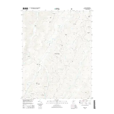
2014 Map of Glady
USGS Topo · Published 2014About this map
Shavers Fork and Glady Fork carve through this high mountain terrain within the Monongahela National Forest, defining a landscape of steep ridges and narrow hollows. The small settlements of Glady, Bemis, and Flint are positioned along the watercourses, reflecting the traditional rail and river orientation of Randolph County's mountain communities. Hikers following the Allegheny Trail traverse high elevations between Spruce Knob and Shavers Mtn, crossing numerous runs and creeks. The map identifies specific family-named water sources like Montoney Spring and William Harris Spring near Miller Hollow, providing valuable geographical markers for genealogists tracing ancestral land tracts in these Appalachian highlands. Elevation rises significantly toward the east at Rich Mtn and Panther Ridge, while the western edge is dominated by the deep drainage of the Shavers Fork valley.
Find a feature on this map
50 named features on this map. Tap any name to fly to it.
Don’t see what you’re looking for? This feature index may not catch every label — zoom into the map to look around manually.
Map Details
Editions of this 2014 Glady Map
This is the sole edition of this map. No revisions or reprints were ever made.
Other maps of this area

1889 · Beverly
USGS Topo · 1:125,000

1892 · Beverly
USGS Topo · 1:125,000

1909 · Elkins
USGS Topo · 1:62,500

1922 · Horton
USGS Topo · 1:48,000

1922 · Spruce Knob
USGS Topo · 1:48,000

1922 · Durbin
USGS Topo · 1:48,000

1924 · Durbin
USGS Topo · 1:62,500

1924 · Horton
USGS Topo · 1:62,500

1924 · Spruce Knob
USGS Topo · 1:62,500

1949 · Charlottesville
USGS Topo · 1:250,000