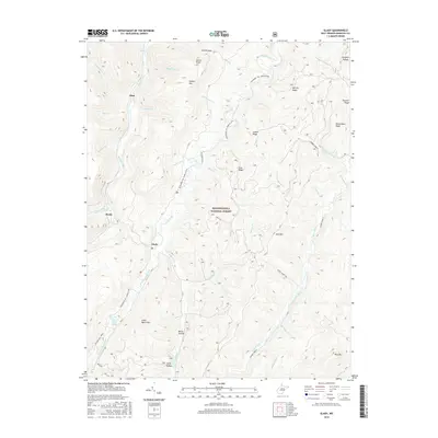
2016 Map of Glady
USGS Topo · Published 2016About this map
Monongahela National Forest dominates this section of the Allegheny Mountains, where the deep drainage of Shavers Fork and Glady Fork carved a landscape of sharp ridges and narrow hollows. Small riverside settlements like Glady and Bemis occupy the rare flat ground alongside the water, connected by the corridor of the W Fork Rail Trail. This rail-to-trail conversion follows the path of former logging or coal lines that once served the remote mountain economy. High elevation points such as Spruce Knob and Shavers Mtn define the horizons, while the Allegheny Tr.: Marlin Mtn. provides a primitive transit route through the backcountry. Family names like William Harris Spring and Miller Hollow indicate a long history of local land use even within the protected forest boundaries, where numerous runs—including Spicclick Run and White Run—feed the headwaters of the regional river system.
Find a feature on this map
52 named features on this map. Tap any name to fly to it.
Don’t see what you’re looking for? This feature index may not catch every label — zoom into the map to look around manually.
Map Details
Editions of this 2016 Glady Map
This is the sole edition of this map. No revisions or reprints were ever made.
Other maps of this area

1889 · Beverly
USGS Topo · 1:125,000

1892 · Beverly
USGS Topo · 1:125,000

1909 · Elkins
USGS Topo · 1:62,500

1922 · Horton
USGS Topo · 1:48,000

1922 · Spruce Knob
USGS Topo · 1:48,000

1922 · Durbin
USGS Topo · 1:48,000

1924 · Durbin
USGS Topo · 1:62,500

1924 · Horton
USGS Topo · 1:62,500

1924 · Spruce Knob
USGS Topo · 1:62,500

1949 · Charlottesville
USGS Topo · 1:250,000