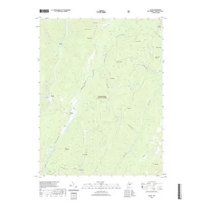
2019 Map of Glady
USGS Topo · Published 2019About this map
Flint, Bemis, and Glady anchor this high-elevation landscape within the Monongahela National Forest. The area is defined by the parallel courses of the Shavers Fork, Glady Fork, and Laurel Fork, which carve through the steep ridges of Shavers Mtn and Marlin Mtn. Local family names and settlement history are reflected in landmarks such as William Harris Spring, Montoney Spring, and Miller Hollow. The terrain is interlaced with notable forest routes including the Allegheny Tr and Stone Camp Run, illustrating a landscape dedicated to timber management and outdoor recreation. Peaks like Spruce Knob and Rich Mtn dominate the horizon, while smaller features like Camp Hollow and Pit Spring provide specific points of interest for genealogists tracing ancestral homesteads or land use in the Randolph County highlands.
Find a feature on this map
49 named features on this map. Tap any name to fly to it.
Don’t see what you’re looking for? This feature index may not catch every label — zoom into the map to look around manually.
Map Details
Editions of this 2019 Glady Map
This is the sole edition of this map. No revisions or reprints were ever made.
Other maps of this area

1889 · Beverly
USGS Topo · 1:125,000

1892 · Beverly
USGS Topo · 1:125,000

1909 · Elkins
USGS Topo · 1:62,500

1922 · Horton
USGS Topo · 1:48,000

1922 · Spruce Knob
USGS Topo · 1:48,000

1922 · Durbin
USGS Topo · 1:48,000

1924 · Durbin
USGS Topo · 1:62,500

1924 · Horton
USGS Topo · 1:62,500

1924 · Spruce Knob
USGS Topo · 1:62,500

1949 · Charlottesville
USGS Topo · 1:250,000