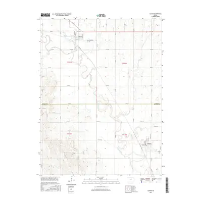
2015 Map of Glasco
USGS Topo · Published 2015About this map
The Solomon River meanders across this landscape, tracing the border between Cloud and Ottawa Counties. In the north, Glasco serves as a primary hub of settlement, where the street grid includes Main St and E Spaulding Ave. The town is supported by local institutions such as the Glasco Saint Mary's Cem-Catholic Cem situated just east of the village. Southward, the community of Delphos sits near the banks of the river, marked by a network of residential streets and the nearby Saint Paul Cem.
Find a feature on this map
70 named features on this map. Tap any name to fly to it.
Don’t see what you’re looking for? This feature index may not catch every label — zoom into the map to look around manually.
Map Details
Editions of this 2015 Glasco Map
This is the sole edition of this map. No revisions or reprints were ever made.
Other maps of this area
1892 · Minneapolis
USGS Topo · 1:125,000
1952 · Glasco SW
USGS Topo · 1:24,000
1952 · Glasco
USGS Topo · 1:24,000
1953 · Glasco NE
USGS Topo · 1:24,000
1953 · Simpson
USGS Topo · 1:24,000

1955 · Manhattan
USGS Topo · 1:250,000
1956 · Manhattan
USGS Topo · 1:250,000
1957 · Manhattan
USGS Topo · 1:250,000
1961 · Tescott NE
USGS Topo · 1:24,000
1964 · Ada
USGS Topo · 1:24,000