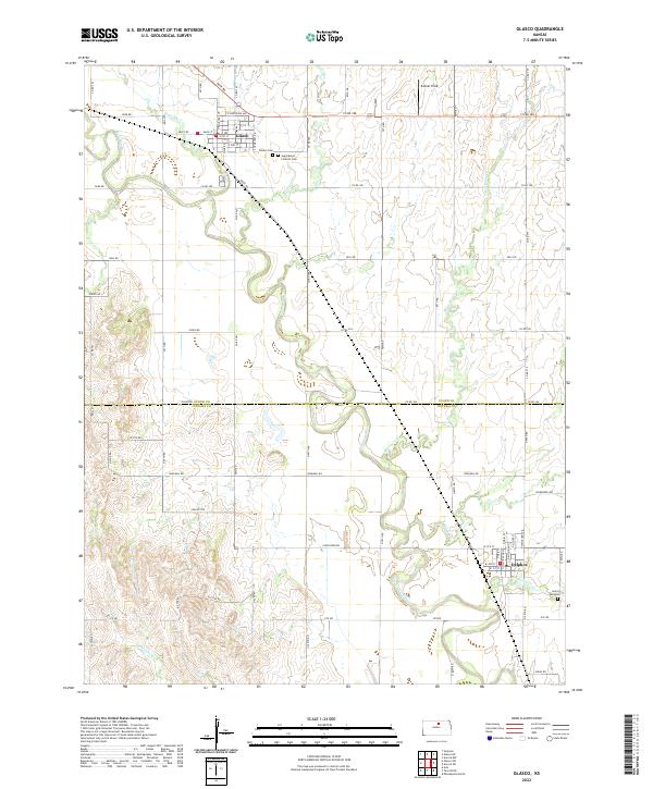
2022 Map of Glasco
USGS Topo · Published 2022About this map
The Solomon River meanders across the border of Cloud Co and Ottawa Co, anchoring a landscape defined by its agricultural grid and river valley topography. This modern survey captures the settled character of North Central Kansas, with the town of Glasco situated in the northern portion and Delphos to the southeast. These communities are connected by a network of rural roads such as Co Rd 767 and Co Rd 775, which navigate around numerous drainages including Fisher Cr, Cris Cr, and Mortimer Cr.
Find a feature on this map
75 named features on this map. Tap any name to fly to it.
Don’t see what you’re looking for? This feature index may not catch every label — zoom into the map to look around manually.
Map Details
Editions of this 2022 Glasco Map
This is the sole edition of this map. No revisions or reprints were ever made.
Other maps of this area

1892 · Minneapolis
USGS Topo · 1:125,000

1952 · Glasco SW
USGS Topo · 1:24,000

1952 · Glasco
USGS Topo · 1:24,000

1953 · Glasco NE
USGS Topo · 1:24,000

1953 · Simpson
USGS Topo · 1:24,000

1955 · Manhattan
USGS Topo · 1:250,000

1956 · Manhattan
USGS Topo · 1:250,000

1957 · Manhattan
USGS Topo · 1:250,000

1961 · Tescott NE
USGS Topo · 1:24,000
1964 · Ada
USGS Topo · 1:24,000