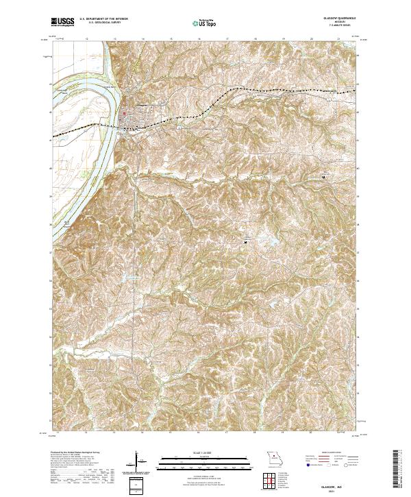
2021 Map of Glasgow
USGS Topo · Published 2021About this map
Glasgow stands prominently on the bluffs of the Missouri River, marking a point where the river makes the sharp Glasgow Bend and Cambridge Bend. This riverfront community, spanning the Saline and Howard County lines, is defined by a traditional street grid including Market St and Washington St. The surrounding countryside reveals a complex network of drainage basins, with Hurricane Creek, Richland Cr, and the Little Chariton River carving through the terrain toward the Missouri. These watercourses have historically shaped the agricultural and transport patterns of the region.
Find a feature on this map
72 named features on this map. Tap any name to fly to it.
Don’t see what you’re looking for? This feature index may not catch every label — zoom into the map to look around manually.
Map Details
Editions of this 2021 Glasgow Map
This is the sole edition of this map. No revisions or reprints were ever made.
Other maps of this area

1890 · Glasgow
USGS Topo · 1:125,000

1947 · Glasgow
USGS Topo · 1:62,500

1952 · New Franklin
USGS Topo · 1:24,000

1953 · Moberly
USGS Topo · 1:250,000

1953 · Fayette
USGS Topo · 1:24,000

1953 · Armstrong
USGS Topo · 1:24,000

1954 · Moberly
USGS Topo · 1:250,000
1956 · Forest Green
USGS Topo · 1:24,000
1956 · Cambridge
USGS Topo · 1:24,000

1957 · Moberly
USGS Topo · 1:250,000