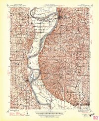
1947 Map of Glasgow
USGS Topo · Published 1947About this map
Glasgow and the surrounding river bluffs of Howard County and Saline County define this post-war landscape, where the Missouri River carves a winding path through Central Missouri. The map illustrates a complex fluvial environment marked by numerous bends, including Glasgow Bend, Cambridge Bend, and Nigger Bend, alongside significant landforms like Epperson Island and Jameson Island. The industrial and transportation patterns of the 1940s are visible through the Gulf Mobile and Ohio RR and the Alton Highway, which facilitated trade and movement across the fertile plains.
Find a feature on this map
83 named features on this map. Tap any name to fly to it.
Don’t see what you’re looking for? This feature index may not catch every label — zoom into the map to look around manually.
Map Details
Editions of this 1947 Glasgow Map
2 editions found
Other maps of this area

1887 · Sedalia
USGS Topo · 1:125,000

1888 · Boonville
USGS Topo · 1:125,000

1890 · Glasgow
USGS Topo · 1:125,000

1890 · Marshall
USGS Topo · 1:125,000

1892 · Marshall
USGS Topo · 1:125,000

1894 · Sedalia
USGS Topo · 1:125,000

1901 · Marshall
USGS Topo · 1:125,000

1940 · Marshall
USGS Topo · 1:62,500

1944 · Marshall
USGS Topo · 1:62,500

1947 · Glasgow
USGS Topo · 1:62,500